Chief Mountain to Polebridge, MT
Section Overview
- Miles: 56.3
- Days: 4
- Start Date: 6/24/23
Day 1
The dramatic shift in scenery I found in front of me can’t be understated. Changing from the New Mexican desert and snow packed mountains of Colorado to the lush and vibrant forests of Glacier National Park was impossible not to smile at. I suddenly felt like I was in a familiar place. Even though I was a thousand miles from the trails I had become familiar with near Seattle and the mountains looked dramatically different, the smells, trees, and even the dirt beneath my feet felt inviting. Unfortunately the mosquitos I am all too familiar with in the Cascades also seemed to be quite happy with the blooming springtime in Montana. It immediately became clear that pausing – even to take photos – would result in quickly becoming swarmed. Regardless, I was happy to be moving forward and surprisingly I wasn’t alone on a trail that is known for being little traveled by thru hikers.

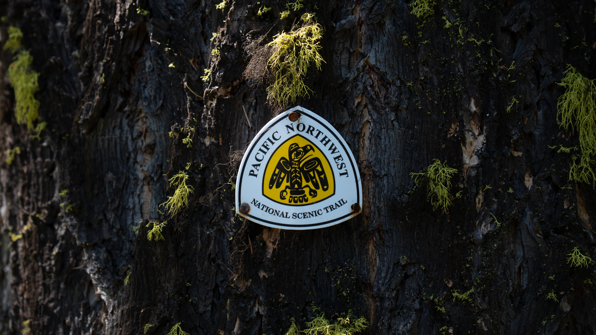
While I was getting permits to cross Glacier, I ran into another hiker, named Connor, doing the same thing. We spent the night at a small campground just outside of the park before hitching up to the eastern terminus of the trail the next morning. I learned that he was in a similar position to me. He had started the year on the PCT and left in the Sierra due to snow. When we reached the terminus we were both surprised to find two other hikers, Vincent and Victor, just starting their thru hike. On a trail that sees so few thru hikers, it felt strange to have four hikers so close together. After a few photos with the yellow thunderbird – the PNT trail maker that often disappears for hundreds of miles – Connor and I entered the park.
Glacier National Park quickly opened up in front of me. I hiked through a blooming valley surrounded by striking peaks and massive cliffs above me while tall grass and vibrant spring flowers brushed against my ankles and knees. I could barely keep my eyes on the trail in front of me. The first day on trail continued to provide spectacular views including a glimpse of Stoney Indian Pass; the first true climb. The pass from a frigid alpine lake seemed impassable with multiple waterfalls plummeting off of a wide cliff band. Somehow there was a trail that wound its way to the top. However, due to permit restrictions my first day would end just before the climb to the pass began.


After getting my first view of tomorrow’s objective, the trail dove into the woods and I quickly became familiar with the massive spring overgrowth. Glacier National Park had melted out fairly early, which meant many peaks and passes were safe to reach, but it also meant the forest floor was alive. The trail disappeared beneath my feet and I was instantly soaked from the waist down. All of the water collecting on the branches and leaves was transferred to me as I pushed through flourishing undergrowth.

My first day on the trail ended at a spectacular lake. It would prove to be a fairly crowded back country site with two CDT hikers, four PNT hikers, and a family of four who had spent a couple nights at the lake. Soon after arriving the family told us a bear had wandered in the camp in search of food and showed a fair amount of aggression towards them and their tent – the evidence was visible as the side of their tent had obvious claw-shaped slashes in it. While we were all a little on edge, they assured us it was only a black bear and we settled in for the evening watching a pair of beavers moving silently through the calm water.

Day 2
The next morning I was slow to get moving. I didn’t have very far to go and I wanted to wait to see if some of the other PNT hikers wanted to stick together through Glacier. Eventually it became impossible to ignore the morning sun and I opened my eyes to discover my shelter had become infested by dozens of unwanted guests. Slugs had taken over the camp and were covering my shelter, backpack, shoes, and quilt. I started picking them off my gear and throwing them into the brush – I would continue finding the slugs in my gear for a couple of days. I packed up my gear and went to retrieve my food from where I had hung it the night before. Connor was doing the same – having a similar experience with the slugs. We left the campground and dove into the undergrowth, instantly becoming soaked through.
The climb up to Stoney Indian Pass was breathtaking. I climbed out of the dense forest and emerged into the direct morning sun surrounded by peaks, waterfalls, and glaciers. It was hard to stop myself from pausing every few minutes to take photos of the scene around me. I reached the pass, encountering a bit of snow still clinging to the ground, and spread my gear out in the direct sunlight in an attempt to dry off from the previous night. I picked a few slugs off my pack I had missed from the morning and started chatting with Connor who had reached the pass just before me.


Leaving the pass was hard. The warm sun had dried my gear and myself out from the morning shower the underbrush had given me. Eventually, though, I packed up and started the long descent into Waterton Valley. After the initial snowy drop to Stoney Indian Lake from open alpine, the trail dropped quickly into the dense forest. I was soon pushing through thick underbrush once again. I was painfully aware of how easy it would be to stumble into a grizzly bear with no warning. I was thankful I was still with Connor and a CDT hiker who reached the pass while we were packing up – the noise of three people hiking and talking would likely scare off any bear long before we encountered it.
When we reached the valley floor, the trails split and we parted ways with the CDT hiker. Our path north quickly became a nightmare. The air in the warm valley came alive with mosquitoes. They hummed around my head and forced me to hike as fast as I could. I nearly started to lightly jog to stay in front of them. Any pause in movement was instantly punished by dozens of mosquitoes descending for a meal. This persisted for 4 miles before we emerged at Waterton Lake, which thankfully had enough wind coming off it to keep the bugs at bay.

Thankfully the Waterton Valley mosquitoes were the worst of my concerns for the rest of the day. The trail up to my second camp on the PNT was muddy, filled with bear and moose tracks, and overgrown, but otherwise an easy stretch. I settled into camp for the night thinking of the day ahead.

Day 3 – Boulder Pass Alternate
The third day I set out solo. I made the decision to take a more northern and higher altitude alternate from the main PNT. Although at this point, I didn’t even know if it was passable. When I got my permits, the ranger didn’t have information on Boulder Pass – the crux of the alternate. I quickly reached Brown Pass and my decision point on whether to take the alternate or not. While Brown Pass seemed trivial – a fairly short and easy climb from camp – it marked my crossing of the Continental Divide. All of the water from here had the same goal as I did – the Pacific Ocean.

The main PNT continued straight and dropped down into the valley in front of me. I could see the Boulder Pass Alternate trail high up on the side of the mountain above me and from what I could see it was snow free. I decided to stick with my original plan and head up towards Boulder Pass knowing that if I ran into any steep snow I would likely have to retrace my steps and head down into the valley on the PNT. As I ascended up towards the pass I came around a bend and got my first full view of my target. I remember laughing to myself at the possibility that it would be passable. The pass looked to be nearly at the same elevation as the peaks on either side of it and full of snow. I could faintly see the trail going up into a cliff band broken up intermittently by patches of snow I would have to find my way through.


I pushed ahead through the uncertainty of the ability to make it over the pass and down the other side. The trail followed the curve of a large bowl in which sat a gorgeous campground that was still closed for the season. I passed the turn off for the campsite and started making my way up the trail to my first obstacle. Two patches of steep snow stood in my way – covering the trail over a loose talus field. After a futile attempt to kick steps into the hardened snow, I dropped down the talus field a hundred feet and traversed underneath the dangerous stretches before regaining the elevation back to the trail. From that point on I was shocked to find the trail was virtually clear of snow until the last stretch before the pass. I relaxed into an easy pace – the only real struggle being keeping my eyes on the trail in front of me. When I reached the pass, I was met by a wave of different emotions. For the first time on the trail I felt like I was in a truly wild place. I hadn’t see anyone the entire day and now I was standing under a dying glacier at over 7,400 feet in elevation, too my north I could see a wall of mountains that reside in Canada, fresh grizzly tracks crossed my path in the snow, and a family of ptarmigans were nervously clucking nearby, halfway through their winter to summer plumage transition.


The descent down the back side of Boulder Pass was straight forward. The snow at the pass quickly disappeared and was soon replaced by overgrowth. A feeling of vulnerability slowly crept into my mind. This was the first time I was fully alone pushing through dense greenery that obscured everything from my chest down. I began randomly calling out hoping that if there was a bear nearby I would scare it off long before I encountered it. As I was singing out loud to myself, I came around a corner and ran right into a couple of day hikers. While I was startled at first, I was happy to see them. They were coming from Kintla Lake – my destination for the night. We chatted for a bit and I learned a hiker had gone over Boulder Pass the day before and while she was there, she was followed and bluff charged by a grizzly.


The rest of the day passed uneventfully. I finally reached my campsite – a front country site just inside the park. I definitely stood out as the only non car-camper at the site. The ranger on duty came over, chatted with me for a while, and gave me some food. I was thankfully able to repay him with a bit of information about the conditions at Boulder Pass and learned about his time exploring the park for the past 30 years.
My fourth day I had a long and dusty road walk into Polebridge, MT. Dropping from the mountains to Big Prairie felt a bit strange. I was suddenly in old farm country. There were even long abandoned homesteads along the road to Polebridge. The town itself consisted of a saloon, mercantile, and a few streets of houses. Everything was powered by large solar panels. I sat down for a beer at the saloon and started talking to a local. He was well aware of the trail and issued a warning for the stretch that lay ahead of me.
Day 4
“Don’t go up Hay Creek alone. Everyone thinks there are a lot of bears are in the park, but they’re really along Hay Creek and it’s all overgrown”


The rest of the day I spent eating pastries from the Polebridge Mercantile and watching the bear dogs run around the property before making my way over to the North Fork Hostel. I had sent a resupply box from East Glacier to the Hostel, but I had no idea if it would be there when I arrived. If it wasn’t there, I would have to wait 3 days for it to be delivered or resupply from the Mercantile. Eating pastries for 3 days didn’t sound too bad. Connor had arrived while I was at the saloon and eventually we decided to head to the hostel for the night. Luckily when I got to there, I was greeted by my package and a bed to sleep in for the night.


